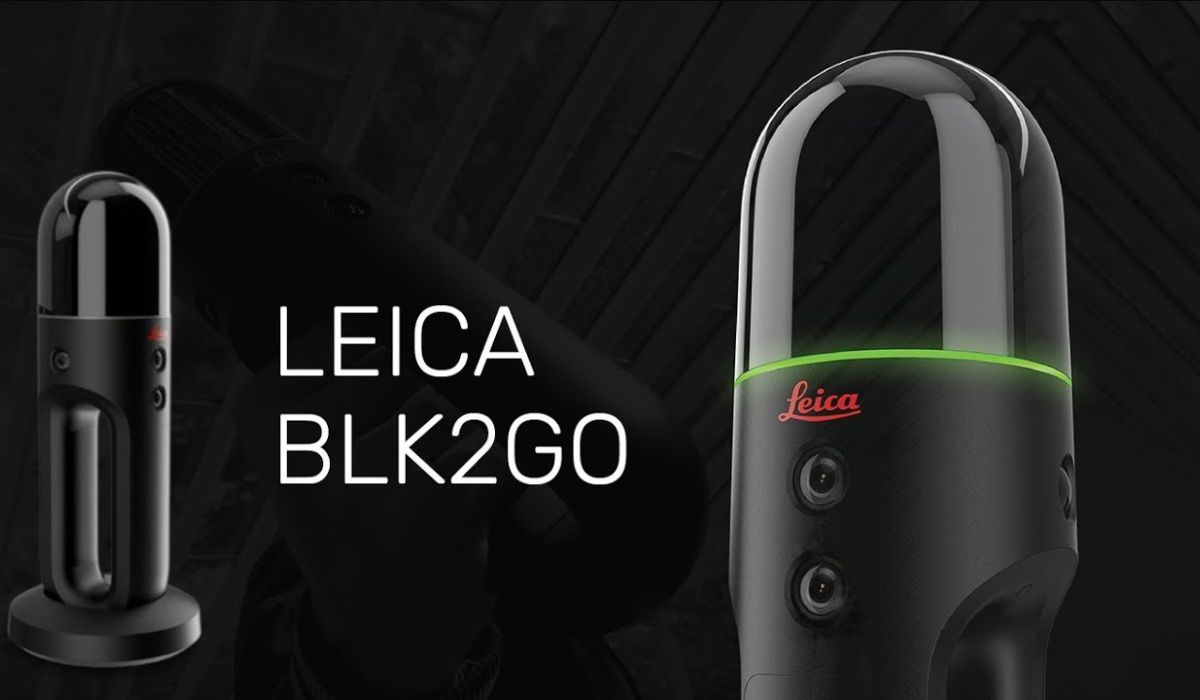
Introducing the Leica BLK2GO: Revolutionising As-Built Drawings in London and the South East
In the fast-paced world of architecture, engineering, and construction, accurate as-built drawings are essential for the success of any project. They provide a comprehensive record of existing conditions, enabling efficient design, planning, and execution of construction projects.
Our practice has now invested in the Leica BLK2GO—an innovative mobile 3D laser scanner that has revolutionised the way we capture accurate point cloud data for producing as-built drawings across London and the South East.
The Leica BLK2GO is a cutting-edge handheld laser scanner that combines simultaneous localisation and mapping (SLAM) technology with 3D imaging capabilities. It is lightweight, portable, and incredibly versatile, making it the perfect tool for capturing accurate measurements and creating detailed point cloud data on the go. With its ease of use and exceptional performance, the BLK2GO has quickly become a game-changer for professionals involved in the construction industry.

One of the key strengths of the Leica BLK2GO is its ability to capture precise point cloud data. The device utilises a combination of LiDAR (Light Detection and Ranging) and SLAM technologies to rapidly scan and map its surroundings in 3D. This process involves emitting laser pulses that bounce back from the environment, allowing the scanner to measure distances and create a detailed representation of the scanned area.
By effortlessly capturing millions of data points per second, the BLK2GO generates highly accurate point cloud data, providing a comprehensive digital representation of existing conditions. This data serves as the foundation for creating as-built drawings with exceptional precision, ensuring that new design elements seamlessly integrate with the existing environment.
While point cloud data is invaluable, it needs to be converted into usable existing drawings for successful project execution. Our practice can use the point cloud data to produce accurate floor plans or elevations suitable for the project.
The use of Leica BLK2GO for as-built drawings has numerous advantages for projects throughout London and the South East. Here are some of the key benefits:
- Time Savings: The efficiency of the BLK2GO enables rapid data capture, significantly reducing the time required for on-site measurements.
- Accuracy and Precision: The high level of accuracy achieved through the BLK2GO’s point cloud data ensures that as-built drawings are faithful representations of existing conditions. This precision minimises errors and discrepancies during the design and construction phases, leading to improved project outcomes.
- Seamless Integration: The detailed point cloud data obtained by the BLK2GO allows for a seamless integration of new designs with existing structures. This integration ensures that new elements fit perfectly within the constraints of the project site, avoiding clashes or conflicts during construction.
- Enhanced Collaboration: The digital nature of as-built drawings produced from point cloud data enables easy sharing and collaboration. Architects, engineers, contractors, and clients can view and interact with the drawings remotely, facilitating effective communication and coordination.
Here’s how it works:
- Laser Scanning: The BLK2GO emits laser pulses that bounce off surfaces, measuring the time it takes for the light to return.
- Time-of-Flight Measurement: By calculating the return time, the BLK2GO determines the distance to scanned objects, creating a 3D representation.
- Simultaneous Localisation and Mapping (SLAM): SLAM technology tracks the scanner’s movement and builds a map of the environment using sensors like accelerometers and cameras.
- Point Cloud Data: The BLK2GO captures millions of data points per second, representing the precise measurements and coordinates of surfaces and objects.
- Data Processing: Software applications process the point cloud data, extracting measurements and dimensions.
- Conversion to Existing Drawings: Processed point cloud data is converted to a compatible format for CAD software, enabling the creation of detailed as-built drawings.
Detailed Planning, are an architectural practice committed to delivering excellence, recognising the transformative power of the Leica BLK2GO in revolutionising as-built drawings. By harnessing this cutting-edge technology, we elevate the accuracy, efficiency and improve the chances of success of your project.


